Welcome to a new era of urban innovation! Today we are going to share how Aerial 3D Rendering for Urban Development is reshaping cityscapes and revolutionizing modern urban planning. Therefore, aerial 3D rendering is being embraced by architects, interior designers, constructors, home developers, and realtors alike.
In this article, we will explore every facet of this technology, its benefits, real-world applications, and future trends. So, buckle up, and let’s take off into the world of breathtaking aerial perspectives—yes, even if you’re afraid of heights, because we promise it will be fun (and maybe a little bit hilarious)!
Understanding Aerial 3D Rendering for Urban Development
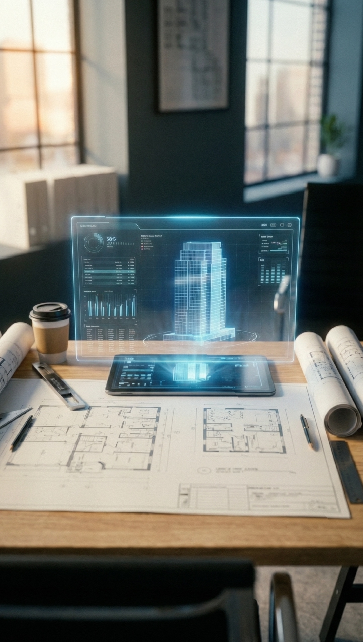
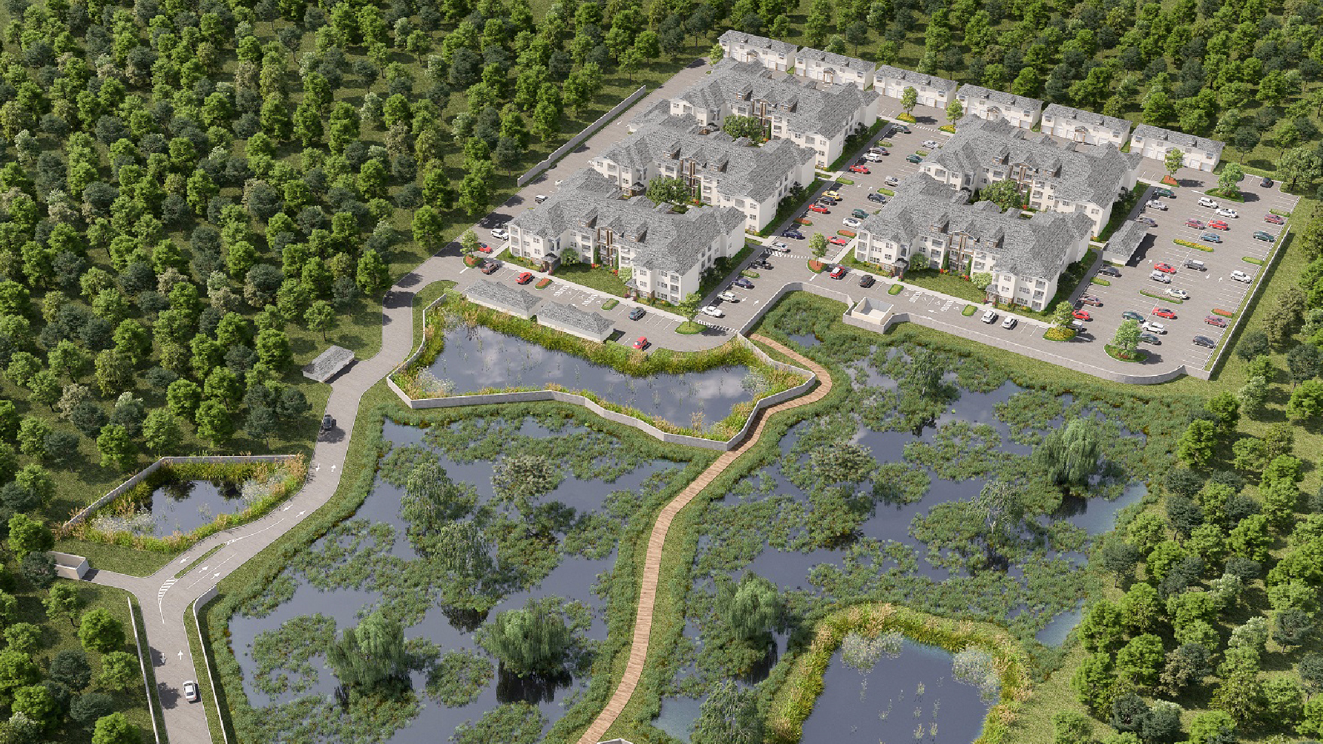
Aerial 3D Rendering for Urban Development is not just a buzzword; it represents a transformative approach to how we visualize and plan cities and urban projects. Traditionally, urban planning relied on flat, two-dimensional maps and blueprints. However, with the advent of advanced drone technology and sophisticated rendering software, urban designers now have the ability to create dynamic, three-dimensional aerial views of entire cityscapes.
In essence:
- Aerial imagery is captured using high-resolution drones.
- 3D rendering techniques are applied to transform these images into lifelike models.
- Urban development projects are then enhanced by these detailed visualizations.
These models are created with such precision that even the minutest details of a site, such as terrain variations and building outlines, are accurately depicted. Consequently, decision-makers can make better-informed choices regarding zoning, infrastructure placement, and aesthetic design.
Moreover, these renderings are used by multiple stakeholders. They are often incorporated into presentations, virtual tours, and digital marketing campaigns. As a result, potential investors and residents can experience a virtual walkthrough of future developments—almost as if they were there in person!

Key Benefits of Aerial 3D Rendering for Urban Development
When we discuss the benefits of Aerial 3D Rendering for Urban Development, it is important to note that this technology has far-reaching impacts that extend well beyond simple visualization. Below are some of the primary advantages:
Enhanced Visual Communication
- Clear and Detailed Perspectives: Aerial 3D renderings provide a bird’s-eye view, allowing stakeholders to grasp the overall layout and context of a project.
- Engaging Presentations: When used in proposals, these renderings make presentations more engaging and persuasive.
- Improved Stakeholder Collaboration: They facilitate a shared understanding among architects, developers, and investors.
Efficient Project Planning and Decision-Making
- Accurate Site Analysis: Urban planners are able to identify potential challenges and opportunities with greater accuracy.
- Cost and Time Savings: By detecting issues early in the planning stage, costly revisions can be minimized.
- Risk Reduction: Enhanced visual data can lead to more secure, well-planned investments.
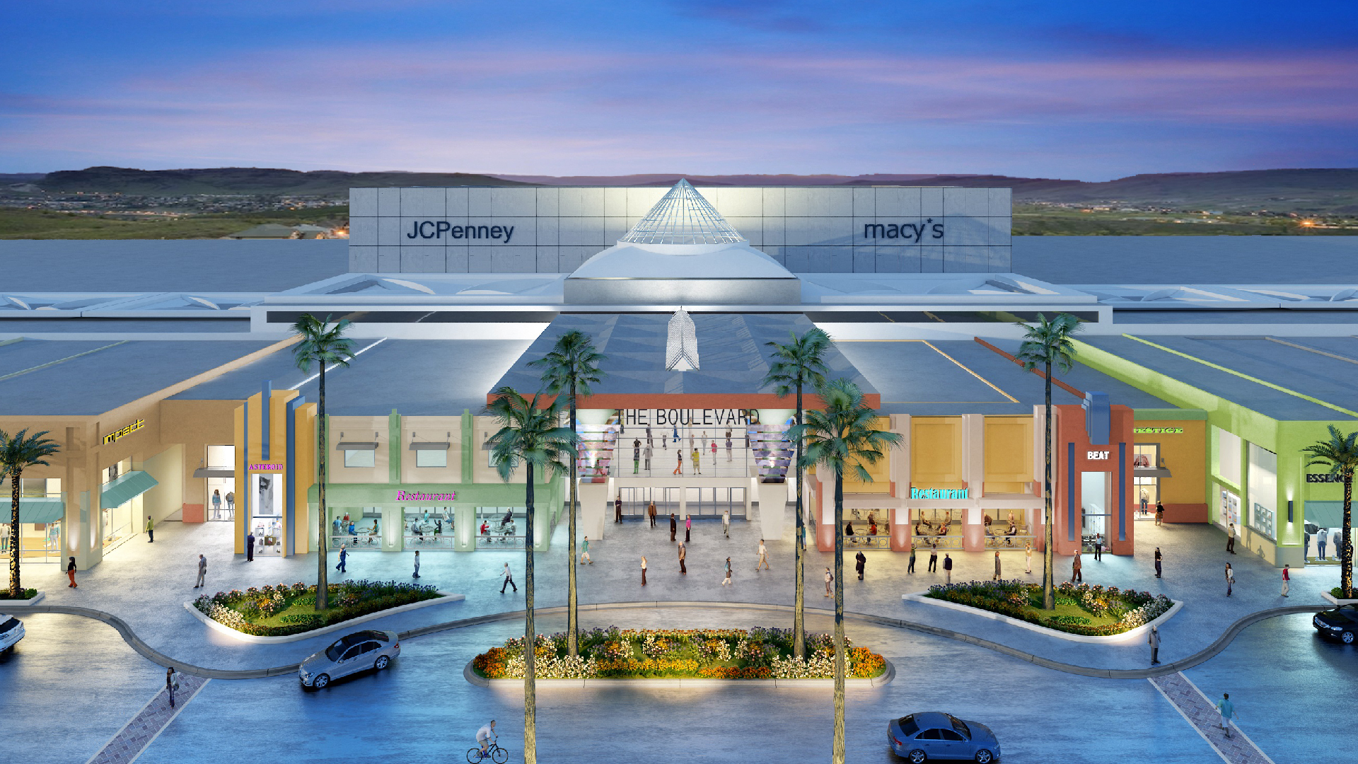
Marketing and Investor Appeal
- Stunning Visuals: Aerial 3D renderings create powerful marketing assets that captivate prospective buyers and investors.
- Brand Differentiation: Developers can stand out in a competitive market by leveraging state-of-the-art technology.
- Enhanced Virtual Tours: These renderings are often integrated with VR360 experiences, making them an excellent tool for showcasing properties remotely.
Sustainability and Innovation
- Eco-Friendly Planning: Better visualization leads to more sustainable designs and infrastructure planning.
- Future-Proofing: The ability to simulate various environmental conditions helps in preparing for long-term urban challenges.
Furthermore, when integrated with other services like floorplans, site plans, and CAD/BIM, the benefits multiply, creating a comprehensive toolkit for modern urban development.
How Aerial 3D Rendering is Transforming Urban Design and Construction
Aerial 3D rendering is now being implemented in virtually every phase of urban development. It has been integrated into the planning, design, and construction stages, making the entire process more efficient and effective.
Early-Stage Urban Planning
At the initial planning stages, aerial 3D renderings are used to:
- Assess Site Feasibility: Drones capture detailed images that are then converted into accurate 3D models.
- Develop Zoning Strategies: Planners can visualize how different zoning laws might affect the project.
- Simulate Environmental Impact: By modeling natural light, shadows, and wind patterns, sustainable designs are formulated.
Indeed, these visual tools are invaluable for brainstorming sessions and preliminary project discussions, where every detail matters.
Design and Visualization
During the design phase, architects and interior designers utilize aerial 3D renderings to:
- Integrate Landscape and Architecture: Seamless integration of natural elements and built environments is achieved.
- Create Immersive Virtual Tours: Clients can explore 3D models interactively, which has been proven to increase project approval rates.
- Iterate Design Concepts: Quick modifications can be made to the renderings to test different design alternatives.
Furthermore, we have observed that even the most complex urban designs can be communicated clearly through these advanced renderings. As a result, clients are often left astonished by the level of detail and realism.
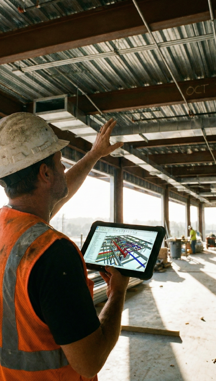
Construction and Site Management
Once the design is finalized, aerial 3D rendering continues to play a critical role during the construction phase:
- Monitor Progress: Regular aerial updates ensure that construction is proceeding as planned.
- Identify Discrepancies: Any deviations from the design can be quickly identified and corrected.
- Coordinate Multiple Teams: Construction managers and contractors are better aligned when visual data is shared in real time.
It should be noted that many construction managers have adopted this technology to enhance efficiency and reduce project delays. Thus, aerial 3D rendering has become indispensable in modern urban development.
Integrating Aerial 3D Rendering with Other 3D Services
In today’s competitive market, a single solution is rarely enough. That is why at Xpress Rendering, we have embraced a holistic approach by integrating Aerial 3D Rendering for Urban Development with our wide array of 3D services.
Combining Aerial 3D Rendering with Site Plans
Our site plans are meticulously designed to complement aerial renderings. In fact, you may find our article “Site Plan Renderings: Everything You Need to Know” particularly insightful. Here, we discuss how detailed site plan renderings provide a foundation for accurate aerial visualizations, ensuring that every component of the development is accounted for.
Integration with CAD and BIM Services
Moreover, our CAD and BIM services are seamlessly integrated with aerial 3D renderings to create comprehensive digital models. This integration allows for:
- Enhanced accuracy: When architectural details are combined with aerial views, the overall design is more precise.
- Better collaboration: All project stakeholders can work from the same detailed model.
- Streamlined workflows: Changes in one element automatically update related models.
If you want to understand the key differences between CAD and BIM and how they complement each other in design and construction, check out this article by Autodesk. It explores how CAD focuses on precise 2D and 3D drafting, while BIM offers a data-rich, collaborative approach to managing a building’s lifecycle.
Complementary Services: Floorplans and Video Animations
Additionally, we offer floorplans and video animations that work in tandem with aerial 3D renderings. These services collectively provide a complete picture of the project, enabling:
- In-depth understanding: Clients can explore interior layouts alongside exterior designs.
- Interactive experiences: Video animations help in visualizing the progression from planning to construction.
- Marketing synergy: A combined presentation of aerial renderings, floorplans, and animations is both engaging and persuasive.
Consequently, the integration of these services ensures that urban development projects are communicated effectively, and potential issues are addressed proactively.
Real-World Applications of Aerial 3D Rendering for Urban Development
To illustrate the transformative power of Aerial 3D Rendering for Urban Development, let us examine some real-world applications:
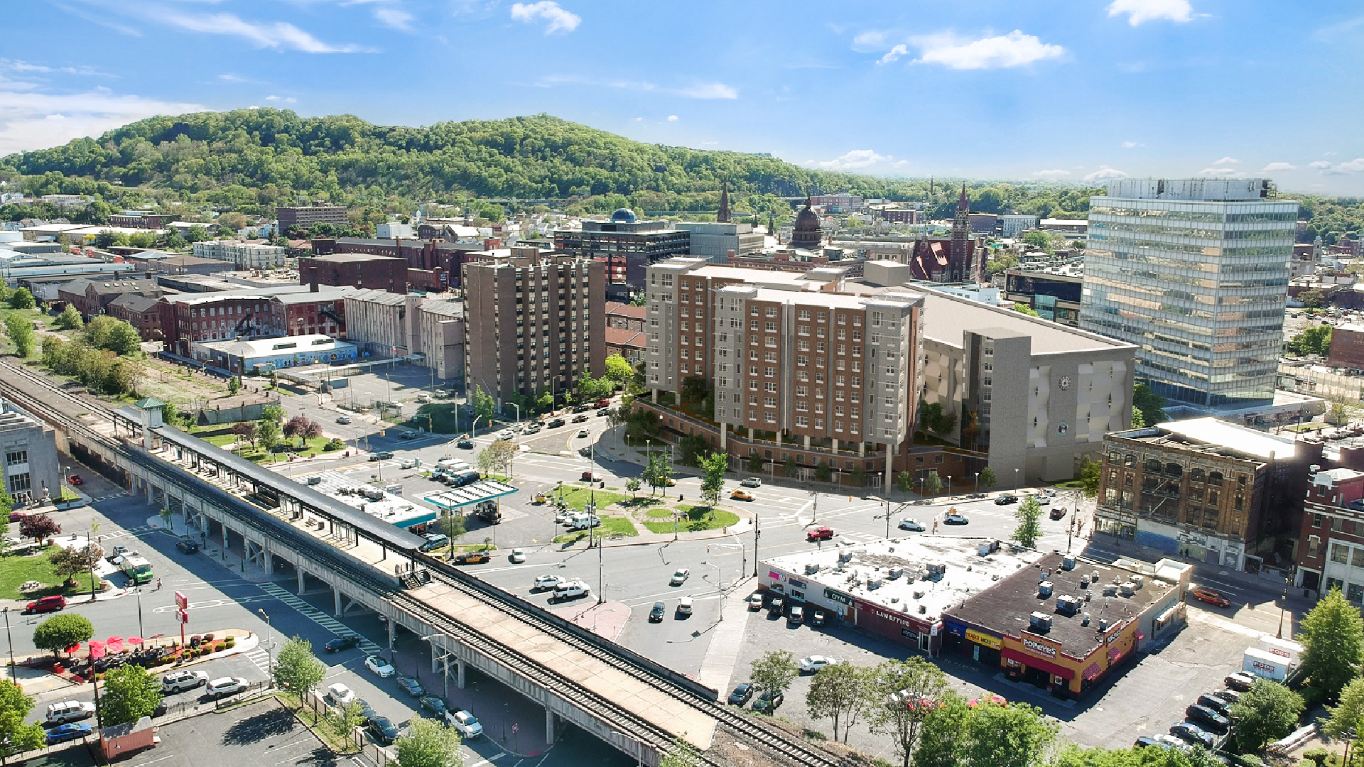
Revitalizing City Centers
Urban centers that have long been plagued by outdated planning techniques have been rejuvenated by aerial 3D rendering. In cities where redevelopment is critical, these renderings provide:
- A comprehensive view of existing structures and open spaces.
- Accurate data to inform urban renewal projects.
- Engaging visualizations that help in attracting investors and community support.
For example, in several major cities, local governments have employed aerial 3D rendering to reimagine public spaces, improve transportation networks, and promote sustainable development. As a result, these cities have experienced a renaissance in both functionality and aesthetic appeal.
Large-Scale Infrastructure Projects
In large-scale projects such as stadiums, transportation hubs, and commercial complexes, aerial 3D renderings are used to:
- Coordinate multiple design elements in a single, unified model.
- Visualize complex interactions between various infrastructure components.
- Ensure compliance with safety and regulatory standards.
This approach has proven successful in ensuring that massive projects are delivered on time and within budget. It has been noted that the clarity provided by aerial 3D renderings significantly reduces the likelihood of costly errors during construction.
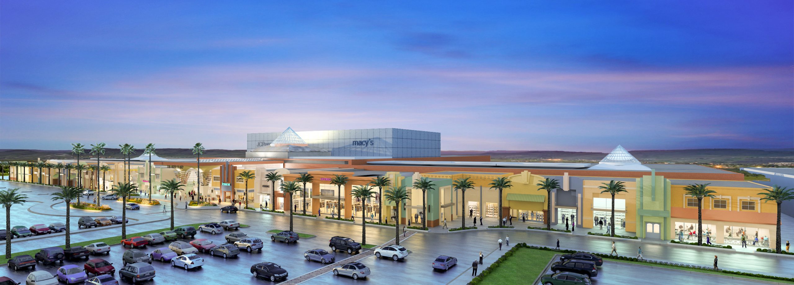
Enhancing Residential Developments
Home developers are increasingly using aerial 3D renderings to:
- Showcase community layouts and amenities.
- Design cohesive neighborhoods that blend modern architecture with natural landscapes.
- Facilitate virtual tours for prospective homeowners.
These renderings are particularly effective in creating an emotional connection with potential buyers. After all, who wouldn’t want to see a stunning, bird’s-eye view of their future community before even stepping foot on the property?
Emerging Trends and Innovations in Aerial 3D Rendering for Urban Development
As technology continues to evolve, Aerial 3D Rendering for Urban Development is set to become even more integral to city planning and construction. Here are some trends and innovations that we believe will shape the future:
Enhanced Data Integration and AI
- Artificial Intelligence: AI is being used to analyze aerial data, predict urban growth patterns, and optimize design elements.
- Real-Time Updates: With continuous data capture from drones, renderings can be updated in real time, ensuring that models remain current.
- Big Data: Integrating data from various sources, including traffic, weather, and demographics, will provide a more comprehensive understanding of urban dynamics.
Immersive Virtual and Augmented Reality
- VR360 Experiences: Virtual reality tours that incorporate aerial 3D renderings offer an immersive experience, allowing stakeholders to virtually “walk through” a project before it is built.
- Augmented Reality: AR applications can overlay digital renderings onto the physical world, enhancing on-site decision-making and collaboration.
- Interactive Simulations: These tools enable users to simulate different scenarios, such as environmental changes or infrastructure modifications, thereby improving planning accuracy.
Sustainable Urban Development
- Green Infrastructure Planning: Aerial 3D renderings can be combined with environmental data to optimize green spaces, water management, and energy efficiency.
- Climate Resilience: By simulating the effects of climate change, urban planners can design more resilient and sustainable communities.
- Community Engagement: Enhanced visualizations foster better communication with local communities, ensuring that development projects align with public interests.
Increased Adoption and Accessibility
- Cost-Effective Solutions: As technology becomes more affordable, smaller developers and local governments can also benefit from high-quality aerial 3D rendering services.
- User-Friendly Software: Innovations in software design are making these tools accessible even to non-experts.
- Global Collaboration: With cloud-based platforms, experts from around the world can collaborate seamlessly, bringing diverse perspectives to urban development projects.
Therefore, the future of aerial 3D rendering is not just exciting—it is revolutionary. It will continue to push the boundaries of what is possible in urban development, ensuring that cities are not only functional but also beautiful and sustainable.
Frequently Asked Questions (FAQs)
1. What is aerial 3D rendering for urban development?
Aerial 3D rendering for urban development is the process of using drone-captured imagery and advanced software to create detailed, three-dimensional visualizations of urban environments. These renderings help stakeholders visualize projects, assess feasibility, and communicate design ideas effectively.
2. How can aerial 3D rendering improve project planning?
By providing accurate, immersive visualizations, aerial 3D rendering enables urban planners and developers to identify potential issues early, reduce errors, and make informed decisions. This technology supports efficient site analysis, enhances stakeholder collaboration, and ultimately saves time and costs during construction.
3. How does aerial 3D rendering integrate with other services at Xpress Rendering?
At Xpress Rendering, aerial 3D rendering is seamlessly integrated with other services such as site plans, floorplans, video animations, and CAD/BIM. This comprehensive approach ensures that every aspect of an urban development project is visualized with precision and clarity, providing a robust toolkit for modern urban planning.
Conclusion
In conclusion, Aerial 3D Rendering for Urban Development is revolutionizing the way we envision, plan, and execute urban projects. Through enhanced visualization, improved planning accuracy, and seamless integration with complementary services, this technology has proven to be a game-changer in modern urban development. We have witnessed how innovative renderings have transformed city centers, streamlined construction, and even increased market appeal for residential and commercial projects.
We invite you to explore our full range of services at Xpress Rendering, including our detailed site plans, 3D renderings, and floorplans. These tools are designed to empower architects, constructors, and home developers to bring their visions to life. If you’re curious to learn more, please visit our blog gallery, and discover how our integrated solutions can elevate your next project.
Now is the time to transform your urban development projects! Contact us today to discuss how we can help you harness the revolutionary power of aerial 3D rendering. Let’s build the future together—one stunning view at a time.